 |
|
| |
View previous topic :: View next topic |
| Author |
Message |
sbkelley
Joined: 20 Feb 2007
Posts: 284
Location: Tempe, AZ
|
 Posted: 7/20/2009, 11:30 pm Post subject: Gannett Peak, WY trip report Posted: 7/20/2009, 11:30 pm Post subject: Gannett Peak, WY trip report |
 |
 |
|
|
Gannett Peak, Wyoming
Day 3 - Summit Day
11 miles, 5600'
Storm clouds over Titcomb Basin.

My hopes had come to fruition. The day before, the winds ripped through camp, testing our tents' integrity, but this storm had all the looks of a cold front. Fast-moving clouds, high winds...usually give way to a nice day the next day, albeit much colder. Perfect for snow conditions. Brian's alarm jarred us from sleep at 3 a.m. We peeked out - not a cloud in the sky, only thin whispers of wind. The decision was made - go for it! We hastily put our gear on, hopped over to Shawn's tent like two kids on Christmas morning anxious to unwrap presents, and asked if he'd be up for going. He went over the benefits of having a rest day, but the positives for a summit bid on a good weather day were too tempting to resist. After checking with Dave one more time to ask if he'd want to go (either this day or the next), we had our team of three ready to rock and roll at 4 a.m.
Shawn couldn't put down any food so early, so we busted out of camp and headed silenty across the upper Titcomb Lake. The snow was perfect. We warmed up, shed a layer on the other side, and continued into icy Titcomb Basin. As we started climbing, I felt sluggish and tired. I hoped it would pass. Shawn and Brian set a brisk pace as we slowly got higher and higher. We approached Bonney Pass, and I could see it was no joke. The icy chute looks intimidating from below, but as usual, it looked steeper than it truly was. In truth, it was a 2,000' grind up a moderate snow slope. It was a grind that nearly knocked me out, a sensation I'm not accustomed to. I had to do something I've not yet done - let the lead guys go and set my own pace, falling a few minutes behind. I'd been practicing this on Piestewa Peak in Arizona throughout the spring and summer and thank goodness I did. It saved my butt this day.
The climb to Bonney Pass seemed endless. Higher and higher we got, and the slope steepened to near 35 degrees. The snow was hard, but steps had been kicked in by previous parties, so the going was manageable. Using the ice axe with the dominant hand, and through a suggestion of Shawn's, a trekking pole in the other, I dragged myself up to Bonney Pass at 6:15 a.m. to a stunning view of Gannett Peak. The route was obvious from here - what was also obvious is that we'd need to drop 1200' of that hard-earned gain to start on the mountain proper.
Gannett Peak from Bonney Pass. The route gains the Dinwoody Glacier at center right, traverses the prominent horizontal snowband to Gooseneck Glacier at right, then heads up the Gooseneck Ridge, and then to the summit ridge.

All thoughts of turning back were now gone. For one, the ice was pretty unsafe for descending back to Titcomb Basin without painstaking care, and for two, the summit was in sight. I ate and refueled. Shawn had been looking at Gannett for about 15 minutes now waiting for me and started to get nervous and cold. Brian was still good to go. We packed up, and headed down, recharging on the downhill section. When we reached the Dinwoody Glacier below, the sun hit us and we ate again, feeling recharged.
Looking up the Dinwoody Glacier to the traverse

Shawn and Brian ready to rock

At this point, there were 3 parties (8 people total) on the route above us that we'd seen all morning. As horrendous as I was feeling, we were noticeably gaining on them. After a steep climb up the Dinwoody Glacier, the route traversed across Gooseneck Ridge onto the glacier. My energy began to return after some Cliff Blocks, and we made good progress up the first steep pitch. We caught up to the first group here - one from Georgia, one from Delaware, and one from Maryland that were having, shall we say, teamwork issues. Amused and happy to be in a party that was getting along, we cut across a short rock pitch onto the upper Gooseneck Glacier, and the summit seemed much closer now.
Looking at the 'schrund (photo taken on descent, but gives you an idea of what the crevasse looked like on July 14)

After a short traverse, the route got spicy. Shawn had plowed ahead, and I saw him poking into the snow. Guess it was time to start playing the "Dodge the Crevasse" game. We were at the 'schrund. Directly in front of us, facing uphill, you could see the route from recent parties. Problem was the crevasse had opened up and cut the well-worn route out. Off to climbers' right, we could see solid snow. Shawn traversed about 20 yards to the right of the crevasse's visible end, tested for stability, and went across. At this point, we made our decision not to rope up. The bridge was solid and would stay that way all day: but it must be strongly noted that this was a team-based decision and does not mean that we'd recommend doing the same. We had harnesses on, had a rope, and had pickets and associated anchor-making gear, but chose not to use it. All we can say is that - on July 14, 2009 from 8 a.m. to 10:30 a.m. (when we descended past it) - the snow bridge was solid enough to cover the crevasse. Use your own judgment when you get to this point - that could easily have changed over the past week.
After the 'schrund, the slope steepened to over 40 degrees as it aimed for the upper Gooseneck Ridge. This stretch really took it out of me. Maybe it was the lack of red blood cells from living in Phoenix at 1100', maybe it was the 15 miles of backpacking with heavy packs from previous days, maybe it was just one of those off-days, but I felt like utter crap again by the time we got to the ridge. However, the summit was a short and easy ridge walk from here. Time to dial it back again and settle in: step, step, step, breath. Repeat.
The final summit ridge - almost there

Shawn and Brian blasted ahead again while I plodded along, getting higher and higher each step. Finally, we got on the summit ridge and the views got expansive. Finally, we reached that jumble of boulders I could see from below. Finally, 21 miles and 3 days of hard work later, all three of us stood atop the highest point of Wyoming. I let out a guttural yell of joy and felt the wave of exhilaration that the other two were feeling. We had done it. We were the first on the summit that day (from the standard route, at least), and it was nice to have the spot to ourselves.
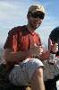
Summit shot!

We snapped photos, refueled again (how can a single person eat this many calories in a day?, I asked myself) and started heading down the ridge. Honestly, I was so focused on foot placement, ice axe/crampon placement, and balance, that I didn't notice the tremendous exposure of the summit ridge. Good thing - the entire west face of the summit block had fractured the day before, adding some spice to the already spicy exposure on both sides. A crampon popped off on me and Brian helped me fix it as we started back onto Gooseneck Ridge, at which point we came across the other parties. One of them had a man hunched over an ice axe, guided, suffering mightily from altitude illness. The group that had pleasant interaction issues came next, with one guy literally pulling on the rope, coaxing his slower teammate along. Yikes.
Shawn and Brian on the descent

From there, the descent was pretty straight-forward. It was now just after 10 and the snow was softening up, which made us think about roping up for the snow bridge back across the 'schrund, but the snow was still solid. We faced out the whole way down the Gooseneck Glacier and quickly found our way back to the relative safety of the lower glacier. The crevasses down here were only starting to open up and made for some cool photos. Before we could celebrate our safe descent, though, we kept looking at Bonney Pass and the 1200' re-climb that awaited our tired legs. Knowing this, we stopped and ate lunch at the bottom of the basin on the Dinwoody Glacier, telling raunchy jokes to keep the spirits up. Must have worked for Shawn: he charged up Bonney Pass, got into a rythym and jack-stomped that climb. It was an impressive feat to watch. Us two Arizonans, on the other hand, were beginning to run on empty. I knew it - I'd been that way all day, it felt - so I got back into my earlier rythym and started chewing up distance. Brian started getting gassed, too, and hung with me. As it got steeper, I'd take 60 steps and rest, take 60 steps and rest, ad nauseum, until we plopped down on top of Bonney Pass. Shawn was waiting for us, ready to start the final descent. I'd conserved my energy nicely, so I was ready to head down, too.
Bonney Pass - what you have to reclimb on the way home

We looked forward to a glissade, but it wasn't to be. The drop off Bonney Pass was steeper than we were comfortable with, and there were intermittent hard layers of snow underneath the soft layer. Some individuals may have been fine with it, but we weren't, so we side-stepped and plunge-stepped our way down to safety and started relaxing.
Shawn and Brian head down Bonney Pass for home

The day was getting broiling hot now as the wind was dead and the full solar radiation on the glacier was certainly going. We all ran out of water on this stretch, but with camp so close and water abundant, we weren't worried. At last we made it to the upper Titcomb Lake, where we ran into two parties (one from Wisconsin, one from Littleton, CO), and gave them any information we could give them about the route. Our campsite looked so long away, but we put our heads down and made it in relative short time, returning to camp at 3 p.m. - an 11 hour day. Nice. Shawn and Brian had busted out in front again, and I staggered in shortly behind them. Dave said he'd never seen me so tired. Probably true.
After sharing our stories from the day, eating a huge dinner (I carried 3 slices of pizza in for this celebratory dinner and it was spectacular), and re-hydrating, our energy returned. We watched Dave and Gabe demonstrate their activity for the day - pummeling an iceberg with boulders. It was fun to watch and our spirits were high after the successful day. We'd done it, even with me being the anchor, we'd set a good time and worked well together.
Gabe plays Stand on the Iceberg in freezing water.

Some parting thoughts:
1) I thought this was harder than Mt. Rainier, at least via the Disappointment Cleaver route. The backpack in is long and your pack is heavy - summit day required going up and over Bonney Pass, and the route was steeper.
2) Shawn is an absolute freak on snow and ice. Impressive, man.
3) Brian's first glacier test was passed with flying colors. Not an easy starter, by any means, and he had no problems. Also impressive.
4) Couldn't have asked for better weather or a better summit team. What an adventure.
5) This was a great time of year to go - the snow was still plentiful and covered up the crevasses well. However, the mosquitoes were horrendous. When a guy from Minnesota tells you they're bad, they're bad.
Incredible Wind River Mountains

_________________
Mountains complement desert as desert complements city, as wilderness complements and completes civilization. - Ed Abbey |
|
| Back to top |
|
 |
GeorgAz

Joined: 04 Jan 2003
Posts: 815
Location: Scottsdale
|
| Posted: 7/21/2009, 5:48 am Post subject: |
|
|
|
|
| AMAZING!!!!!!!! You guys ROCK! Thabks for the journey and the incredible photos!! |
|
| Back to top |
|
|
Zarff

Joined: 04 May 2005
Posts: 43
Location: Mesa, AZ
|
| Posted: 7/21/2009, 6:46 am Post subject: |
|
|
|
|
Very Nice.!!!.
I enjoyed the read and the pics. 
_________________
*****************
Dan |
|
| Back to top |
|
|
windymesa

Joined: 06 Jan 2004
Posts: 76
Location: Peoria, Arizona
|
| Posted: 7/21/2009, 7:51 pm Post subject: |
|
|
|
|
Thanks for the pics of the Winds... you pushed my button... so much snow this year... surely now Lake Powell will rise, and give us water for more golf courses. Your day of climbing Gannet was truely super human. Your last picture shows Island Lake in the forground, and Fremont Peak (middle) and Jackson Peak to the right of Fremont. Fremont (13, 745') is 59 feet lower than Gannet, and is the 3rd highest peak in Wyoming (the Grand Teton is 2nd). Jackson Peak is a mere 13,517', but both Fremont and Jackson can be walked up with no technical gear or glacier strolling.... and give us slackers one heck of a view. You can see the Teton's from Fremont (and I presume Gannet) on a clear day. You crawl up Fremont on the steep face you are looking at.. reach the top and look 1500 feet down on the impressive Upper Fremont Glacier. Us slackers can also safely play on a glacier by going through the gap (Indian Pass) in my photo on the right of Jackson Peak, and there you are on the Knife Point Glacier. Us older, weak people camp high at 11,000 in Indian Basin (fewer if any mosquitos), then climb up Fremont for a short 3500' 8 mile RT climb.
So much snow this year in your photos!!!... go here to see a photo of Fremont-Jackson taken at the same time (mid-July) with a lot less snow in 2005.
http://outdoors.webshots.com/photo/2090314000103823771bDXpTq
No place like the Winds to recharge the batteries.... climbing the high peaks not required. Watchout for the grizzlies coming into the Northern half... thanks to the USFWS Grizzly Recovery Program (Wyoming G&F plan to keep the griz north of Boulder Creek). Hike in a large group, and be able to run faster than at least one other person. |
|
| Back to top |
|
|
Desert-Boonie

Joined: 23 Nov 2004
Posts: 219
Location: Glendale, AZ
|
| Posted: 7/21/2009, 8:39 pm Post subject: |
|
|
|
|
Very Nice!!!
_________________
~Never Satisfied~
"If I can't be my own, I'd feel better dead" |
|
| Back to top |
|
|
sbkelley
Joined: 20 Feb 2007
Posts: 284
Location: Tempe, AZ
|
| Posted: 7/22/2009, 12:07 am Post subject: |
|
|
|
|
Windymesa,
Such a difference in the snowpack! We wanted to hit Gannett in early to mid-July before the crevasses opened up on the glaciers. They were just starting to, and by now, may be even more so.
You're right - no peak-climbing required to enjoy this area. Long as you have DEET or a mosquito net, the views and lakes are spectacular from the moment you leave the car.
Ken,
You should have no trouble with this one when you try...as for a view off the summit, well....
_________________
Mountains complement desert as desert complements city, as wilderness complements and completes civilization. - Ed Abbey |
|
| Back to top |
|
|
Davis2001R6

Joined: 12 Dec 2003
Posts: 5591
Location: Italy
|
| Posted: 7/22/2009, 4:43 am Post subject: |
|
|
|
|
Nice work guys, wish I could have joined you. Probably would have sat at camp since I would have managed to get blisters on the hike in though  Amazing pictures too, I need to get out for a hike. Amazing pictures too, I need to get out for a hike. |
|
| Back to top |
|
|
GeorgAz
Joined: 04 Jan 2003
Posts: 815
Location: Scottsdale
|
| Posted: 7/22/2009, 6:50 am Post subject: |
|
|
|
|
| I'll be going to Glacier in Sept. and will see how the snopack is doing there. |
|
| Back to top |
|
|
kurthzone
Thread Killer

Joined: 31 Dec 2002
Posts: 1097
Location: Peoria, Arizona
|
| Posted: 7/22/2009, 4:12 pm Post subject: |
|
|
|
|
Good job Scott. Nice report.
_________________
;o)> |
|
| Back to top |
|
|
oliverr99

Joined: 04 Jul 2006
Posts: 632
Location: Glendale
|
| Posted: 7/24/2009, 8:14 am Post subject: |
|
|
|
|
I enjoyed your pictures!
_________________
Anne
"Don't cry because it's over, smile because it happened" -- Dr. Seuss |
|
| Back to top |
|
|
gpsjoe

Joined: 01 Feb 2004
Posts: 535
Location: Mesa AZ
|
| Posted: 7/24/2009, 10:16 am Post subject: |
|
|
|
|
Nice trip and great pics. GB and I jsut got back from doing the "Cirque of the Towers" where we stayed 3 nights at basecamp at Lonesome Lake. Need to go through 320 pics before selecting and posting. Great trip, and yes, lots of mosquitos to keep us company.
_________________
Become a skilled GPS user and it will set you free! |
|
| Back to top |
|
|
lzyboy

Joined: 21 Nov 2004
Posts: 201
Location: Mesa
|
| Posted: 7/24/2009, 8:49 pm Post subject: |
|
|
|
|
Great report Scott, and what an adventure!
I saw the comment about the trekking pole in tandem with the ice axe and it sounded scary to me, but I researched it a bit, and when I saw Ed Viesturs on the summit of Nanga Parbat with a pole and an axe, and saw all the advantages, and thought back to all the times it would have been a welcome addition, it only seems reasonable, so thanks for that. And thanks for the opportunity to share your adventure! You guys rock! (Well, you, and Joe, and GB, and Letty, and all you Wind River crazies!)
Pete
_________________
I see my path, but I don't know where it leads. Not knowing where I'm going is what inspires me to travel it.
Rosalia de Castro |
|
| Back to top |
|
|
RedRoxx44
Queen of the Walkabout

Joined: 15 Jan 2004
Posts: 1167
|
| Posted: 7/25/2009, 10:29 pm Post subject: |
|
|
|
|
Daaammmn, everyone's going there now!! Great trip report on Gannett, I saw it albeit across the way. Awesome trip also GPSjoe and GB. I just got back from about 40 miles of heaven in the northern section, had swollen rivers to cross, snow fields up high and of course those lovely alpine lakes. Very little, and old, bear sign. I'll work on my trip report and a billion pics later.
_________________
You can rest when you're dead |
|
| Back to top |
|
|
Shawn
I'll sell you map to Lost Dutchman mine!
Joined: 03 Jan 2003
Posts: 2592
Location: Ahwatukee, AZ
|
| Posted: 7/26/2009, 4:04 pm Post subject: |
|
|
|
|
Welcome home, I was thinking it was about time.
_________________
The bear went over the mountain to see what he could see. |
|
| Back to top |
|
|
sbkelley
Joined: 20 Feb 2007
Posts: 284
Location: Tempe, AZ
|
| Posted: 7/26/2009, 6:17 pm Post subject: |
|
|
|
|
Looks like the secret is out about the Winds!
Look forward to gpsjoe and Letty's TRs as well. Not like you can pick a bad spot in the area to visit!
lzyboy - yeah, I was skeptical of the axe/pole tandem at first as well. But it worked well. We put the pole away on the glacier, but on the snow climb, it was pretty handy
_________________
Mountains complement desert as desert complements city, as wilderness complements and completes civilization. - Ed Abbey |
|
| Back to top |
|
|
|
Back to top
|
|
|
You cannot post new topics in this forum
You cannot reply to topics in this forum
You cannot edit your posts in this forum
You cannot delete your posts in this forum
You cannot vote in polls in this forum
|
|


 Hosted by Gartman
Technical Services.
Hosted by Gartman
Technical Services.